


Jackson Voting District, Monroe County, Arkansas
About
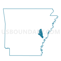
Outline

Summary
| Unique Area Identifier | 527393 |
| Name | Jackson Voting District |
| County | Monroe County |
| State | Arkansas |
| Area (square miles) | 61.37 |
| Land Area (square miles) | 59.67 |
| Water Area (square miles) | 1.70 |
| % of Land Area | 97.22 |
| % of Water Area | 2.78 |
| Latitude of the Internal Point | 34.52292150 |
| Longtitude of the Internal Point | -91.18266610 |
Maps


Graphs
Select a template below for downloading or customizing gragh for Jackson Voting District, Monroe County, Arkansas


Neighbors
Neighoring Voting District (by Name) Neighboring Voting District on the Map
- Cleburne Voting District, Monroe County, AR
- Crockett Voting District, Arkansas County, AR
- Cypress Voting District, Phillips County, AR
- Duncan Voting District, Monroe County, AR
- Keaton Voting District, Arkansas County, AR
- Roc Roe Voting District, Monroe County, AR
- Smalley Voting District, Monroe County, AR
Top 10 Neighboring County Subdivision (by Population) Neighboring County Subdivision on the Map
- Keaton township, Arkansas County, AR (892)
- Duncan township, Monroe County, AR (801)
- Roc Roe township, Monroe County, AR (296)
- Cypress township, Phillips County, AR (152)
- Montgomery-Smalley township, Monroe County, AR (134)
- Jackson township, Monroe County, AR (121)
- Crockett township, Arkansas County, AR (104)
- Cleburne township, Monroe County, AR (62)
Top 10 Neighboring Unified School District (by Population) Neighboring Unified School District on the Map
- Stuttgart School District, AR (10,681)
- DeWitt School District, AR (8,785)
- Clarendon School District, AR (3,706)
- Marvell School District, AR (3,087)
Top 10 Neighboring State Legislative District Lower Chamber (by Population) Neighboring State Legislative District Lower Chamber on the Map
- State House District 14, AR (25,762)
- State House District 51, AR (23,525)
- State House District 12, AR (22,630)
- State House District 13, AR (21,757)
Top 10 Neighboring State Legislative District Upper Chamber (by Population) Neighboring State Legislative District Upper Chamber on the Map
- State Senate District 28, AR (91,744)
- State Senate District 17, AR (71,695)
- State Senate District 5, AR (63,334)
Top 10 Neighboring 111th Congressional District (by Population) Neighboring 111th Congressional District on the Map
Top 10 Neighboring Census Tract (by Population) Neighboring Census Tract on the Map
- Census Tract 4802, Phillips County, AR (5,903)
- Census Tract 9503, Monroe County, AR (2,222)
- Census Tract 9502, Monroe County, AR (2,140)
- Census Tract 4801, Arkansas County, AR (1,435)